ESPACE - Earth Oriented Space Science and Technology - an international Master's program at the Technical University of Munich for Space Engineering and its applications: Earth System Science, Remote Sensing, and Navigation
ESPACE's primary goal is to educate future satellite application engineers. Students gain fundamental knowledge in space engineering and specialize in satellite applications related to navigation, remote sensing and Earth system science. This combination of disciplines distinguishes ESPACE from other master's programs in related fields.
Background and Objectives
"Satellite applications such as car navigation systems, weather predictions, Google EarthTM, and tsunami warnings play an important role in our daily lives. All of these things are made possible by satellites. Many more applications not only for science but also for people's daily lives are expected in the future. If you would like to know more about the inner workings of satellites, their orbits, their sensor systems, about data processing, modeling and interpretation, and use this knowledge for a future career, ESPACE is the right Master's program to choose. ESPACE offers you the chance to work with top professors and lecturers from universities, research institutes and industry in and around Munich while studying at one of Germany's best universities. Our objective is to lead our students toward a future in a real, high technology field and to produce satellite application engineers."
--Professor Reiner Rummel, former ESPACE Director and former Chair of the Institute for Astronomical and Physical Geodesy, TUM
How the ESPACE Master's program was founded as a Satellite Application Engineering Program
Earth observation satellites help us better understand and monitor our environment. Today, researchers within climatology, oceanography, meteorology as well as national agencies and logistics companies are all dependent on up-to-date satellite data. Design, development and data analysis of respective satellite missions require experts with knowledge not only in spacecraft design and orbit mechanics but also in satellite applications, as well as Earth system science, remote sensing and navigation. From an educational point of view, this diversity is a challenge. Classical university programs cover parts of this spectrum in different disciplines. These are aerospace engineering, electronic engineering or geodesy - just to mention a few - yet there is hardly any connection between these parts.
Therefore, several institutions in and around Munich decided to combine their expertise and set up a graduate program with the aim of educating Satellite Application Engineers. The result is the ESPACE Master's program, established in 2005.
ESPACE benefits from and utilizes its location in Munich with its unique concentration of expertise related to space science and technology. The ESPACE Master's program is coordinated at the Technical University Munich with excellent teaching staff from
- 3 universities (Technical University of Munich, Ludwig-Maximilian University, University of the Federal Armed Forces)
- Research institutions (such as the German Aerospace Center, DLR and the German Geodetic Research Institute, TUM-DGFI)
- Space industry (such as Airbus Defence and Space, OHB, OroraTech, Isar Aerospace and many others)
Please view the Degree Program Documentation (here from winter semester 2019/20 and here valid from winter semester 2024/25) and especially the Program Structure (chapter 6 of the Degree Program Documentation) for more details on the general structure of ESPACE. You can also read the detailed compilation of all offered modules (valid from winter semester 2019/20) or the detailed compilation of all offered modules (valid from winter semester 2024/25 – not yet published as they have not been finalized).
The successful participation in all examinations and the completion of the Master's thesis leads to the academic title M.Sc. (Master of Science) in Earth Oriented Space Science and Technology.
ESPACE Alumni can be best described as satellite application engineers, now working or doing PhD studies in national space agencies, space industry, research institutions, or universities.
Satellite Application Engineering
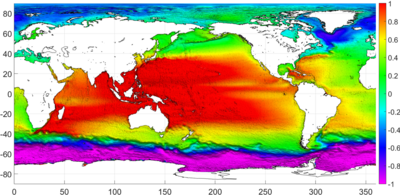
Earth System Science: Ocean topography map based on satellite data
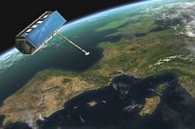
Remote Sensing: The German radar satellite TerraSAR-X delivers SAR images day and night, regardless of weather conditions
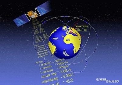
Navigation: European navigation system GALILEO
The purpose of Earth-observing satellites is to monitor and understand our planet. Up-to-date satellite data is important for a range of applications to study of our Earth system.
Satellite data is the basis for studies on global change for modelling geophysical processes, e.g., in the fields of climate, water cycle or geodynamics. A specialization in Earth System Science imparts know-how in the modelling of such complex processes and contains lectures in oceanography, atmospheric physics, and geophysical fluids, among others.
Remote sensing is a key technology for the acquisition of geoinformation. It uses and interprets measurements from a variety of sensors, e.g., radar, laser, thermal or optical cameras. Remote sensing data is crucial for understanding and modeling the complex Earth system, environmental monitoring, updating geographic information systems (GIS), or security-related issues, especially for remote areas with difficult access. The specialization remote sensing contains lectures on image processing, geoinformation, photogrammetry, and advanced remote sensing.
Today, traffic control and modern logistics are dependent on reliable navigation systems, such as GPS or the European GALILEO system. The key component of such systems is accurate positioning. Global navigation systems (GNSS) also play an important role for measuring geodynamic processes such as plate motion, deformation monitoring, or precise orbit determination of satellites. The specialization Navigation imparts advanced processing techniques and hardware aspects of precise positioning.
Observation from space not only requires knowledge of the Earth but also of the satellite system. This includes know-how in spacecraft technology, orbit mechanics, and attitude and orbit control. These aspects will be part of the core curriculum (first year) for all ESPACE students.
Core curriculum in the program's first year: foundations of space engineering and science as well as an introduction to remote sensing, geo-sciences, and navigation.
Institutes contributing to ESPACE
There are several different university departments and institutes in and around Munich that contribute to ESPACE (in alphabetic order):
- Chair of Astronautics
- Chair of Cartography
- Chair of Communication and Navigation
- Chair of Data Science in Earth Observation
- Chair of Pico and Nano Satellites, and Satellite Constellations
- Chair of Remote Sensing Technology
- Institute for Astronomical and Physical Geodesy
- Professorship for Big Geospatial Data Management
- Professorship for Earth System Modelling
- Professorship of Photogrammetry and Remote Sensing
- Professorship of Remote Sensing Applications
Interested in ESPACE? Visit the section on how to apply for ESPACE.
Within the course of Earth Observation Satellite Mission Data Analysis according to Software Engineering Standards five students of the ESPACE Master’s program submitted a proposal for the Copernicus Masters University Challenge 2018. Their concept of a smart marine safety routing application for small-scale vessels includes the consideration of all kind of environmental and marine traffic factors and is available for PCs as well as mobile phones. The students could convince the jury, and move to the final round by prevailing over a variety of applicants, that came from more than 10 countries.
The Copernicus Masters University Challenge is open for students and research associate from all over the world who submit their innovative Earth observation solutions.
